| WEST HENRICO CO. - GLEN ALLEN VA SNOWFALL FOR 2013-2014 WINTER'S TOTAL 17.2 inches & 17.7 inches with May 22nd Hail | ||||||
| BACK TO CURRENT SNOW TABLE | SNOWS OF PAST WINTERS | |||||
| Days |
Snow Month |
Snow Day |
Total Snow Inches |
Rating Hourly Chart |
Time Lapse Movie |
Remarks |
| 1 | Nov. | 12 | T | No Chart Event 1 |
No | Only light snow flurries from 12:25 to 12:45 PM the temperature was 41.8 °F when the first flakes were observed (just discernible) and cooled to around 38 °F when the flurries became easly seen which was around 12:30 to 12:40 PM. All snow flakes melted on contact with all surfaces. |
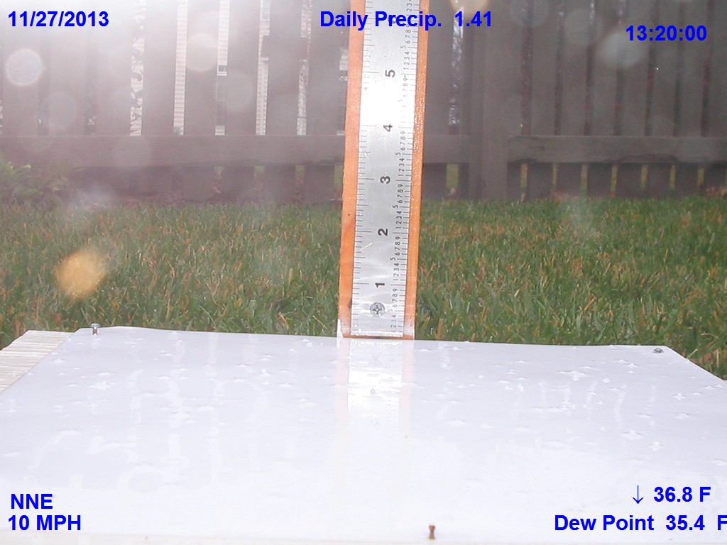
| 2 | Nov. | 27 | T | No Chart Event 2 Picture |
No | Only very light periods of sleet with the heaviest period between 1310 and 1320. The one picture shows a few grains of sleet before they completely melt around 1320 but all of the frozen precipitation melted within ten minutes of falling on the snow board. |
| 3 | Dec. | 8 | 0.1 | Chart Event 3 |
Yes | The 0.1 frozen precipitation was sleet between 1230 and 1300. Most of the storm was freezing rain or glaze with no snow. The maximum amout of glaze was 0.2 inches on colder objects like metal objects. Herb in Northern MD got 8.2 inches from the storm. Harrisonburg had 1.0 inch of sleet and frozen precipitation. |
| 4 | Jan. | 2 | 0.2 | Chart Event 4 |
Yes | Rain started at 1458 and changed to snow around 2200 hours after having 0.32 inches of rain. The temperature was above freezing during the snow event and melting occurred during the snow. The total precipitation in the storm was 0.36 inches or 0.04 inches was snow but because of melting the maximum measured on the snow board was 0.2 inches. A few flurries occurred between 0035 and 0110 on the 3rd but wasn't enough to measure. Boston had more than a foot of snow and parts of SE New York state and along the New England coast got the greatest snow totals. |
| 5 | Jan | 16 | 2.0 | Chart Storm 1 |
Yes | Rain on January 15th turned to sleet at 1948 with a temperature of 46.8 °F and thunder heard twice. On and off light sleet until about 15 minutes past midnight when the sleet became heavy again but lasted only a short time into the 16th and the sleet became light again. The light sleet didn't turn to snow until 0300 and the snow was light until 0645 when it became moderate to heavy and lasted until 0800. From 0800 to 0900 the snow tappered to flurries and ended around 0900. |
| 6 | Jan. | 21-22 | 1.9 | Chart Storm 2 |
Yes | The storm had a snow band that moved through between 1146 and 1300 but the temperature was above freezing and it all melted and then no additional snow until1555. The temperature was now 28.7 °F no problem, but wind gust of 20 mph that wouldn't let the light snow accumulate on the snow boards. The wind continued between 20 and 25 mph during most of the snowfall and was difficult to measure. The snow was blown away from snow boards on the ground much less elevated snow boards. Many reported 2 to 3 inches but were probably measured on grass. The ground was still warm from the residual heat of the 60 °F of yesterday so you could not measure on bare ground or streets as the snow was melting from the underside. Even the liquid precipitation was a problem because of the wind. |
| 7 | Jan. | 28-29 | 3.1 | Chart Storm 3 |
Yes | The snow started at 1545 and stopped after 10 minutes and started again at 1650. The snow ended around 0400 with snow that was filled with dendrites. Only snow and snow pellets in this storm and upper level low pressure added to the snow at Glen Allen. If you observe snow closely you will find most snows are irregular broken crystals of snow. The commonly shown dendrites shown for snow are really not that common. This was the coldest snow in the history of Richmond area. The January 30, 2010 snow of 9.5 inches was a cold snow the high was 27 °F and the low 18 °F a daily mean of 22.5 °F. But this snow was colder. The maximum yesterday was 27 °F and the minimum was 14 °F for a daily mean of 21.0 °F. I believe this is the coldest snow of more than 1.5 inch Richmond has had since March 1, 1980. Not many would look to the month of March for the coldest snow! On March 1, 1980 the Richmond International Airport had 10.6 inches of snow and the high temperature was 21 °F and the low was 13 °F giving a daily mean of only 17 °F. Taking a core sample this morning on the total depth of snow 3.1 and melted out only 0.17 inches of water. This gives a snow to water ratio of (18 to 1) a very dry snow indeed! The snow from midnight until it ended was even drier than the snow on the 28th. The snow pellets that occurred before midnight made the snow to liquid ratio lower (12 to 1). We had about 1hour and 40 minutes of snow pellets from 2240 to 0020. |
| 8 | Feb. | 13-14 | 5.7 | Chart Storm 4 |
Yes | The storm total was 5.7 inches the most in one storm since February 5-6, 2010 when 11.1 inches fell. The snow started February 12th at 1627 and by midnight the snow total was 4.6 inches. Maximum one hour snow fall intensity was 1.0 inch between 2145 - 2245 on February 12th The liquid precipitation February 12 to midnight was 0.50 inches. Then 20 minutes after midnight the grauple transitioned over to mainly sleet and by 0200 of February 13th another 0.6 inches of sleet and snow was recorded on the snow boards that were cleared at midnight. At 0140 a little freezing rain mixed with sleet that became all freezing rain between 0220 and 0225. At sunrise of the 13th the total precip. since midnight was 0.84 inches and for the storm 1.34 inches and the snowstorm total was 5.2 inches. About 0.59 inches of freezing rain was apart of the 0.84 inches of liquid since midnight. At 0700 this morning glaze on the upper surfaces of horizontal twigs 0.2 inch and 0.1 inch on the undersides. During the morning there was a little freezing drizzle that just became drizzle and the glaze melted off the trees and vinyl of the house. Then at 1423 we had 2 lightning strikes - one was rather close and the thunder was loud and pea size hail fell for 3-5 minutes then became sleet. Some called this sleet but it was really hail as it was very spherical and too large for sleet. These spherical objects had obviously been lifted and dropped by updrafts in the thunderstorm in order to accrete to the size that they had. The barograph also showed a quick rise and fall in pressure indicating convection. The snow then started again from the wrap-around on the back side of the storm. The snow started with large flakes that became light snow and ended at 2115. The additonal frozen precipitation added 0.5 inches to bring the storm total to 5.7 inches. It would have been more but this last precipitation was melting while it was accumulating. |
| 9 | Feb. | 17-18 | Trace | No Chart Event 5 Picture |
Yes | This was a minor event with a trace of snow pellets from 2343 to 2400 on the 17th. Then on the 18 a heavier period of snow pellets between 0305 to 0510. The picture shows the accumulation just after sunrise. It was almost enough to call 0.1 inches but was better called a trace. |
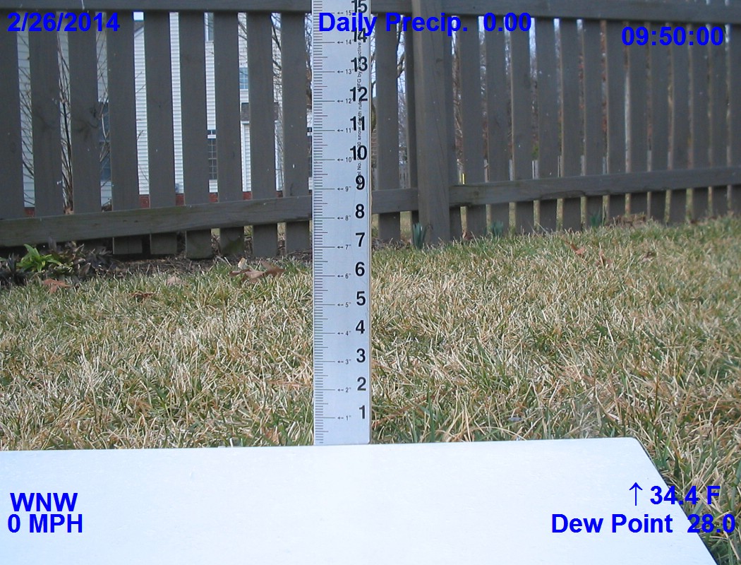
| 10 | Feb. | 26 | T | No Chart Event 6 Picture |
No | Very light now flurries between 0905 and 1000. The heaviest flurry was between 0940 and 0950. The temperature was above freezing and it melted as it fell. The picture shows how light the snow flurry was when looking at the fence boards. |
| 11 | March | 3 | 2.4 | Chart Storm 5 |
Yes | This storm came from two low pressures that tracked a very cold artic front. It started as rain on March 2 after a 72 °F maximum temperature giving 0.12 inches by midnight. The rain turned into sleet at 0535 and the sleet was heavy at times giving about 0.5 inches before changing over to all snow at 0800. The strongest wind was 29 mph at 0758 during the change over to snow. The wind made snow measurments dificult blowing snow off the snowboards. The hardest snow was between 0900 and 1000 giving 0.6 inches in one hour. The cold front advanched a little faster than expected and all the moderate snow was over by 1130 thus forecast amounts were less than expected. There were on and off flurries until 1600 and one period of light snow between 1500 and 1600. It was all over by 1615 and the sun came out for a short time from 1630 to 1645. |
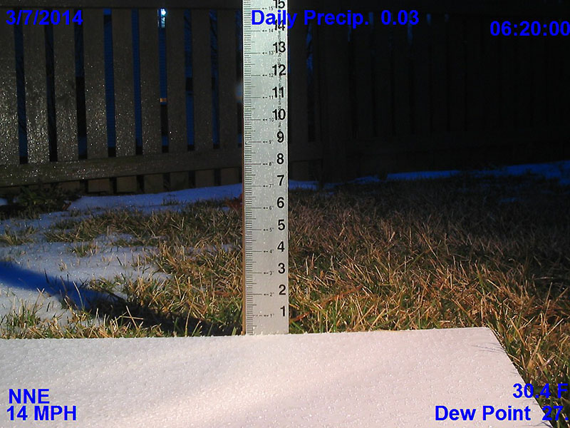
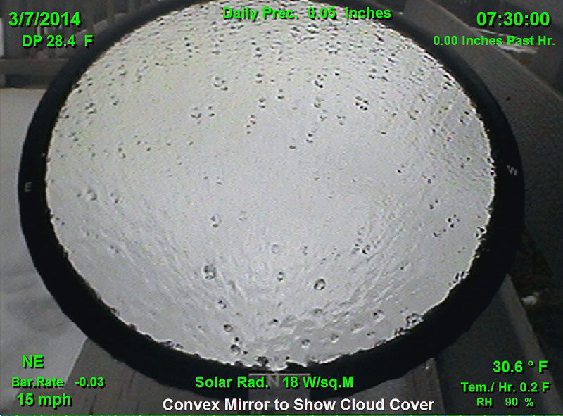
| 12 | March | 7 | T | No Chart Event 7 Picture 1 Picture 2 |
No | A very light freezing rain started at 0323. Then freezing rain with sleet started at 0515. The maximum accumulation of sleet occurred at 0615 (wasn't enough to measure) then only freezing rain that ended at 0730. The temperature went above freezing 0920 and most of the glaze melted by 1130. Then rain started at 1150 and lasted until 1740 with temperatures above freezing and two periods of very light sleet. During this event there was never enough frozen precipitation to measure. |
| 13 | March | 16-17 | 1.4 | Chart Storm 6 |
Yes | This was a long duration storm that started at 1625 on March 16th as rain. The rain mixed with sleet at 1715 and was a mix of rain snow and sleet by 1727. Heavy sleet occurred at 1950 but only lasted 5 minutes and by midnight the temperature dropped to 31.2°F and freezing rain was falling with 0.1 inches of sleet on the snow board. A heavy period of sleet occurred around 0030. The forecast was for 3 to 5 inches of snow but the storm was almost all sleet until 0752 when some light snow started. There was 0.7 to 0.8 inches of mainly sleet when the snow started. During the day periods of light snow brought the total up to 1.4 inches including the 0.1 inches of sleet from yesterday. Then during the evening and night into the morning of the 18th 0.05 inches of freezing rain occurred. |
| 14 | March | 25 | 0.4 | Chart Event 8 |
Yes | The precipitation started as a very light snow at 0635 and by 0830 was only 0.1 inches deep. The temperature then went above the freezing point and all the snow melted but snow continued to fall and mix with rain at 1000. The snow melted as it fell and the precipitated ended as rain at 1050 and a high temperature of 47°F was reached. The precipitation started as rain again at 1450 and by 1900 it started to mix with snow again. It was all snow after a short period of mixed precipitation and with the temperature still above freezing 0.3 inches of additional snow accumulated. The precipitation ended by 2155 with no additional accumulation actually 0.1 inches was lost by melting by 2155. The light was not turned on the snow board after sunset for a little over one hour and much of the 0.3 inches of snow fell during this period of dark. The total snowfall was 0.4 inches with 0.1 inches in the morning and 0.3 inches in the evening. |
| 15 | ||||||
| BACK TO LINKS | ||||||